You are currently viewing Hiking Minnesota: Autumn Leaves on Eagle Mountain, Boundary Waters Canoe Area Wilderness & Superior National Forest

Hiking Minnesota: Autumn Leaves on Eagle Mountain, Boundary Waters Canoe Area Wilderness & Superior National Forest

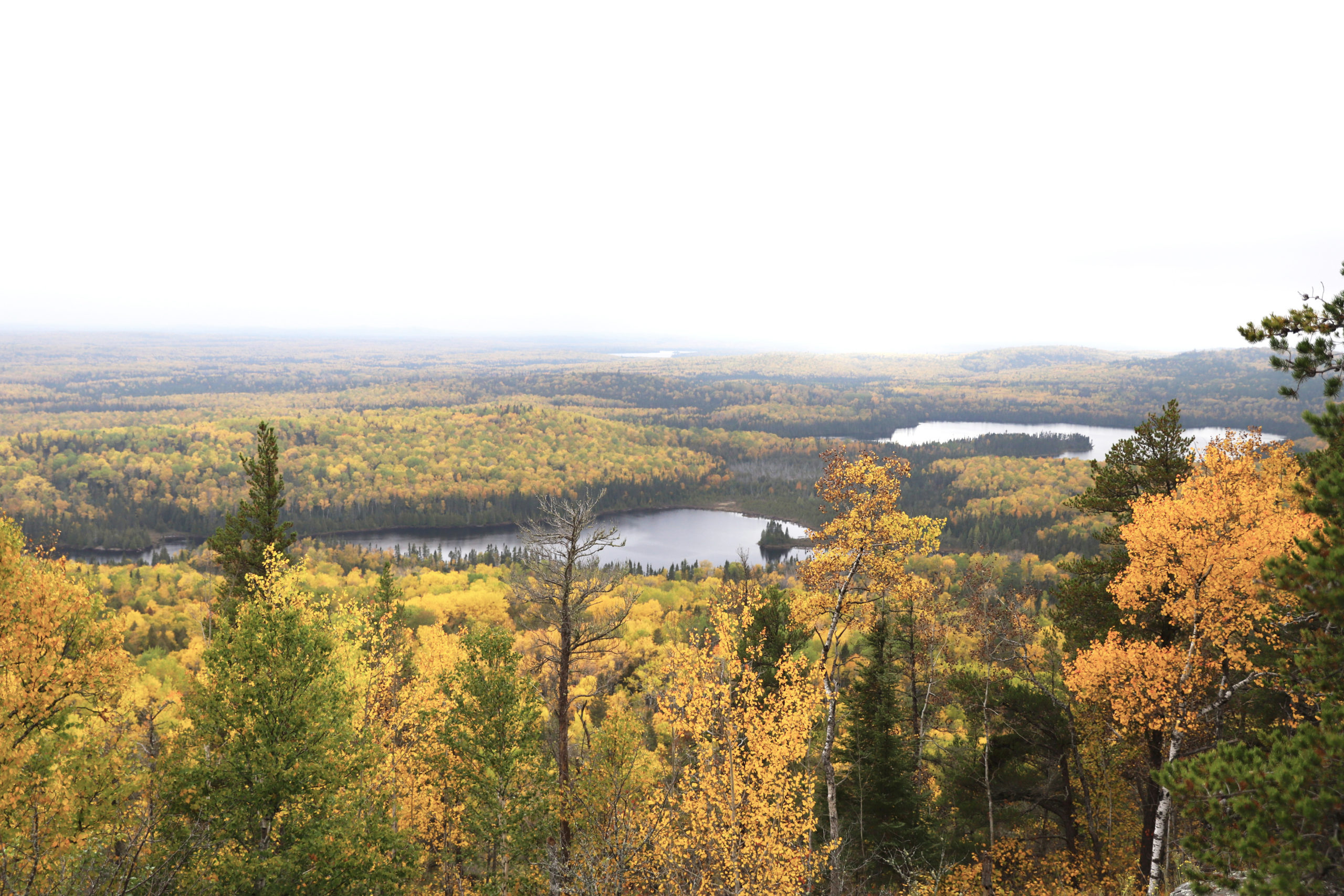
Cole has been wanting to hike Eagle Mountain with the boys to see the autumn colors. Eagle Mountain is the highest point in Minnesota with incredible views of the Boundary Waters Canoe Area Wilderness (BWCAW) and Superior National Forest. This weekend was the perfect time to make the trip as fall colors were at their peak and the boys had a long weekend off from school.

The first time Cole and I hiked Eagle Mountain, we were brand new parents with a baby in the carrier. It was fun to be back again, this time with all three kids and a dog! Our family has grown and all proved to be excellent hikers, even the dog. 

It was so refreshing to unplug and go off-grid for the long weekend. We soaked up the autumn beauty of the Midwest wilderness, and treasured quality time together with our boys. To top it all off, we listened to messages shared from leaders of the Church of Jesus Christ of Latter-day Saints at the semi-annual worldwide General Conference. Thanks to SiriusXM satellite radio we were able to listen live even in the wilderness!

Eagle Mountain is a fun, moderately challenging hike with big payoff views from the summit. A plaque and elevation marker can be found at the top indicating Eagle Mountain as the highest natural point in the state of Minnesota at 2,302 ft. Views of the BWCAW and Superior National Forest from the summit make this hike one of the most rewarding in the state.  

Things to Know: Eagle Mountain

*Trailhead: Located on the north side of FR170.

*Directions: From MN 61, turn north on County Road 4 (Caribou Trail) just north of Lutsen. Follow Co4 until it ends at FR170. Turn right on FR170 and proceed 3 1/2 miles to the Eagle Mountain Trailhead parking lot. The lot is on the left (north) side of the road.

*Parking: Available for FREE at the trailhead.

*Distance: 7 miles out and back.

*Difficulty: Moderately challenging.

*Elevation gain: 656 ft.

*Time: 2.5 hours.

*Fee: No fee. 

Tips:

*Trail is within the BWCAW, and maintained as a wilderness trail so it will be narrow with uneven footing caused by rocks and roots, no stairs, and will not be cleared frequently.  

*You are responsible for being adequately prepared for the wilderness: good footwear, ample water, emergency supplies, and sufficient time to make the trip.  

*You should be self sufficient: there is no cell phone coverage, and no easy way to get assistance in/out in emergencies.

*BWCAW permit may be required. If hiking for the day, you can use a FREE self-issue permit. Instructions and permit found at the trailhead kiosk.  

*Best times to visit are April – October.

*Bring lots of water and snacks for kids.

*Dogs welcome but must be on leash.

Related Blog Posts

*Eagle Mountain, Minnesota

*Summit of Ishizuchi-san, Japan

*Hiking Mount Rogers, Virginia

*Old Rag Mountain, Shenandoah National Park, Virginia

*More camping related blog posts

*More hiking related blog posts

Shop Photography Prints

Re-enacting the photo we took here many years ago. Now he’s all grown! Click here to see the original.

And now we have three!